Troutmap River Maps Colorado – Arkansas River
Original price was: $25.95.$20.76Current price is: $20.76.
Save: 20%
Description
Source to BV
This map set follows Colorado’s Arkansas River for 40 miles from Leadville toBuena Vista; including Hayden Meadows (Class 2 rapids), Pine Creek (Class 4-5+ rapids), The Numbers (Class 4-5 rapids), and The Narrows (Class 3-4 rapids).
10 river maps and an area map
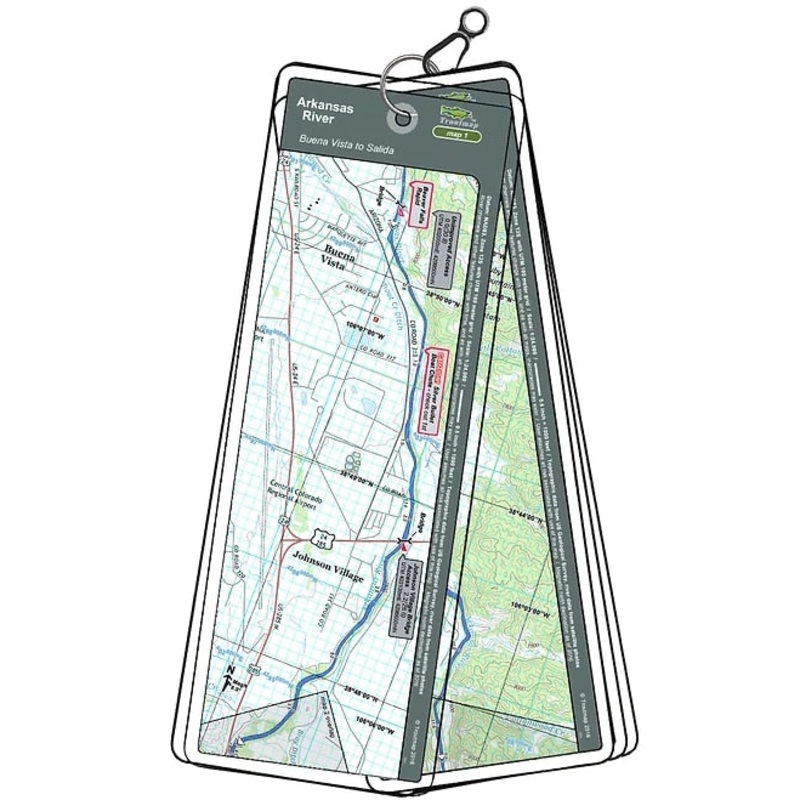
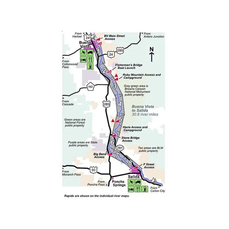
BV to Salida
This map set follows Colorado’s Arkansas River for 30.8 miles from Buena Vista to Salida; including Browns Canyon (Class 3-4 rapids).
8 river maps and an area map
Salida to Canon City + Tailwaters
This map set includes the area between Salida and Caon City. Salida to Texas Creek is premier fly fishing water by wading or floating with fewer rapids (Class 2-3). From Texas Creek, the map set includes Parkdale (Class 3-4 rapids), and the Royal Gorge section(class 4-5 rapids). The Pueblo Resevoir Tailwater is also included, which is a small wading area with possibilities for good sized trout.
18 river maps and 3 area maps, 68.4river miles
Product Info:
- Laminated and waterproof maps that follow the river channel.
- Individual maps are secured with a stainless steel split ring, and includes asnap hook that allows clipping to a cable retractor on waders or boat.
- Cable retractor is not included
- River features such as rapids, boat ramps, access points, and campgrounds are clearly shown.
- Each map set contains an area map showing the general location of fly shops, shuttles, lodging, fuel and places to eat.
- Approximatesize: printed map:3-3/8 inches by 10-1/4inches;laminated page:3-3/4 inches by 10-1/2inches.
Related products
-
Sale!

The Drake Magazine|Fall 2024|Spring 2024|Winter 24-25|Spring 2025|Summer 2025
Original price was: $10.00.$8.00Current price is: $8.00.Save: 20%
Add to cart -
Sale!
Troutmap River Maps Montana – Madison River
Original price was: $26.95.$21.56Current price is: $21.56.Save: 20%
Add to cart -
Sale!
Salmon by Mark Kurlansky|Hard Cover
Original price was: $39.99.$31.99Current price is: $31.99.Save: 20%
Add to cart


Reviews
There are no reviews yet.