Sale!
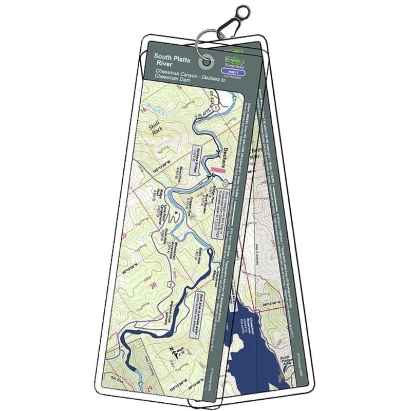
Troutmap River Maps Colorado – South Platte River
Original price was: $19.95.$15.96Current price is: $15.96.
Save: 20%
Color_MT:
Description
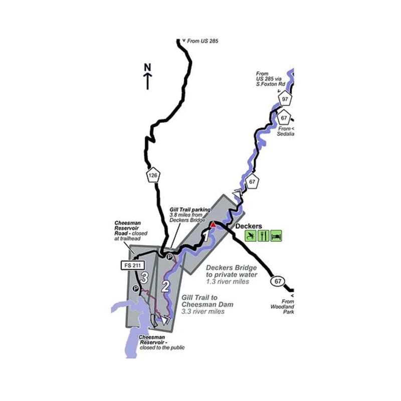
Cheesman Canyon Dam to Deckers
The Cheeseman Canyon section of Colorado’s South Platte river is a narrow scenic canyon with Gold Medal fly fishing for trout with Phd’s in avoiding your offerings – they’ve seen it all. Come on – you’re smarter than a trout, right?
Because this is a hiking/wading river only, the Troutmaps are at a larger scale for greater detail over the short 3.3 river miles from the Gill Trail to Cheesman Dam.
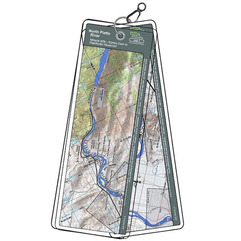
2 river maps and 2area maps
Product Info:
- Laminated and waterproof maps that follow the river channel.
- Individual maps are secured with a stainless steel split ring, and includes asnap hook that allows clipping to a cable retractor on waders or boat.
- Cable retractor is not included
- River features such as rapids, boat ramps, access points, and campgrounds are clearly shown.
- Each map set contains an area map showing the general location of fly shops, shuttles, lodging, fuel and places to eat.
- Approximatesize: printed map:3-3/8 inches by 10-1/4inches;laminated page:3-3/4 inches by 10-1/2inches.
Related products
-
Sale!
Troutmap River Maps Colorado – Gunnison River
Original price was: $24.95.$19.96Current price is: $19.96.Save: 20%
Add to cart -
Sale!
Troutmap River Maps Utah – Green River
Original price was: $36.95.$29.56Current price is: $29.56.Save: 20%
Add to cart -
Sale!
Troutmap River Maps Wyoming – North Platte River
Original price was: $24.95.$19.96Current price is: $19.96.Save: 20%
Add to cart
Reviews
There are no reviews yet.